BicesterMasterplanApplication
The landscape strategy applies eco-town principles to the proposed development at north west Bicester. It combines public realm, water management (SUDs) and habitat protection within a connected green infrastructure network. The exemplar area demonstrates this approach through the relationship between development edges, a retained riparian corridor and adjoining open spaces.
- Location
- Bicester, U.K.
- Type
- Masterplanning
- Year
- 2016
- Role
- Landscape design, research and graphics support
- Medium
- Hand sketches and digital media
- Contribution
- Researched green infrastructure strategies, supported the project graphics and developed the exemplar area as the basis for the wider landscape concept.







Concept
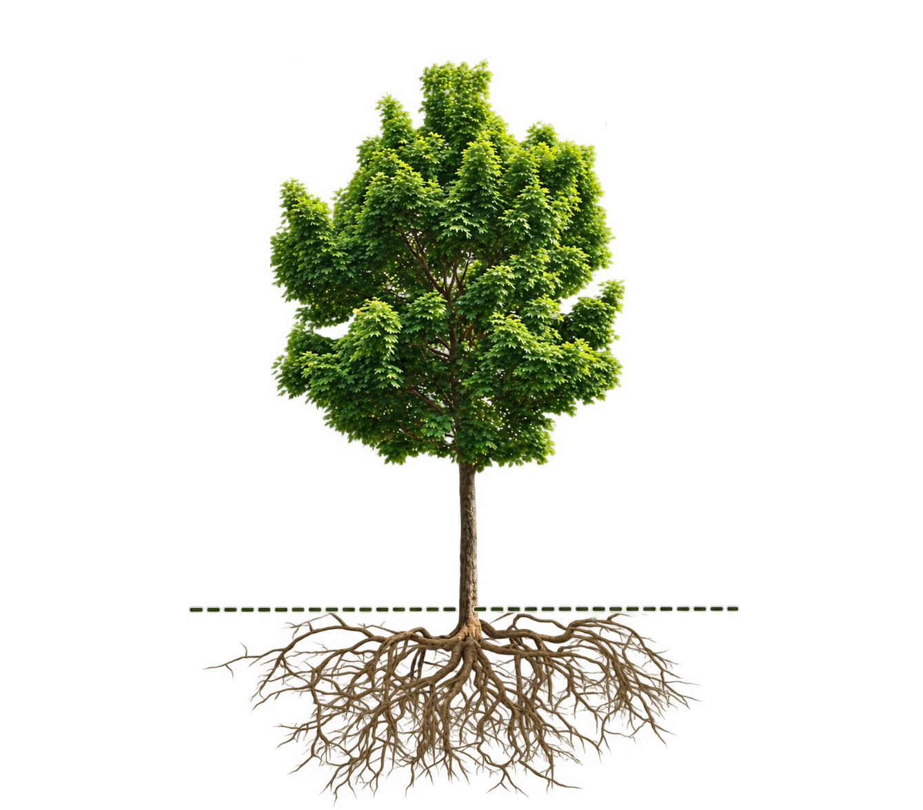
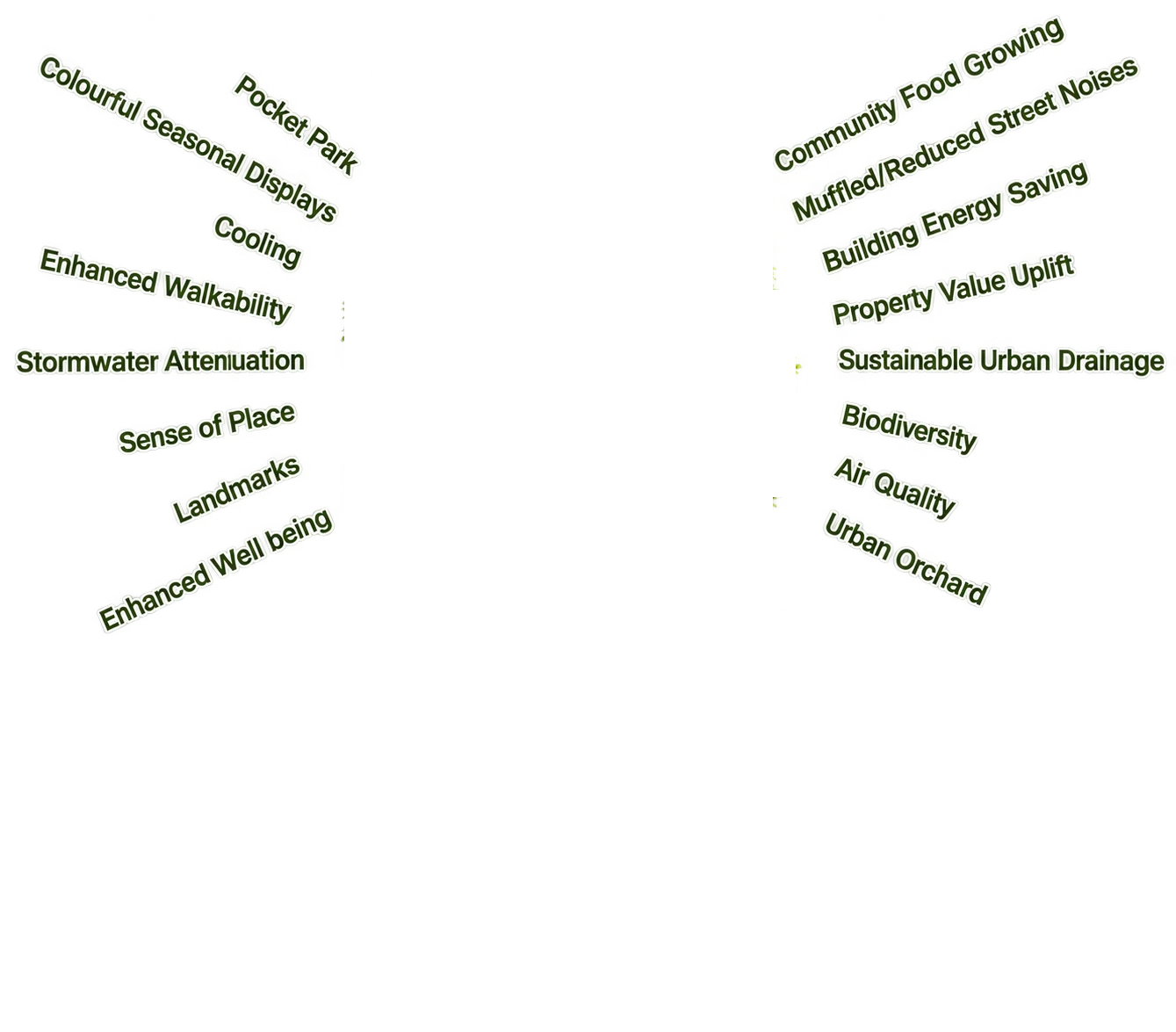
Urban benefits
Green infrastructure provides the environmental and social framework for the development, combining biodiversity, water management and public amenity within a multifunctional landscape.
Space to …
The concept responds to people’s need for space to breathe, move, connect, grow, learn, play and share, translating these needs into the provision and character of open spaces.
Analysis
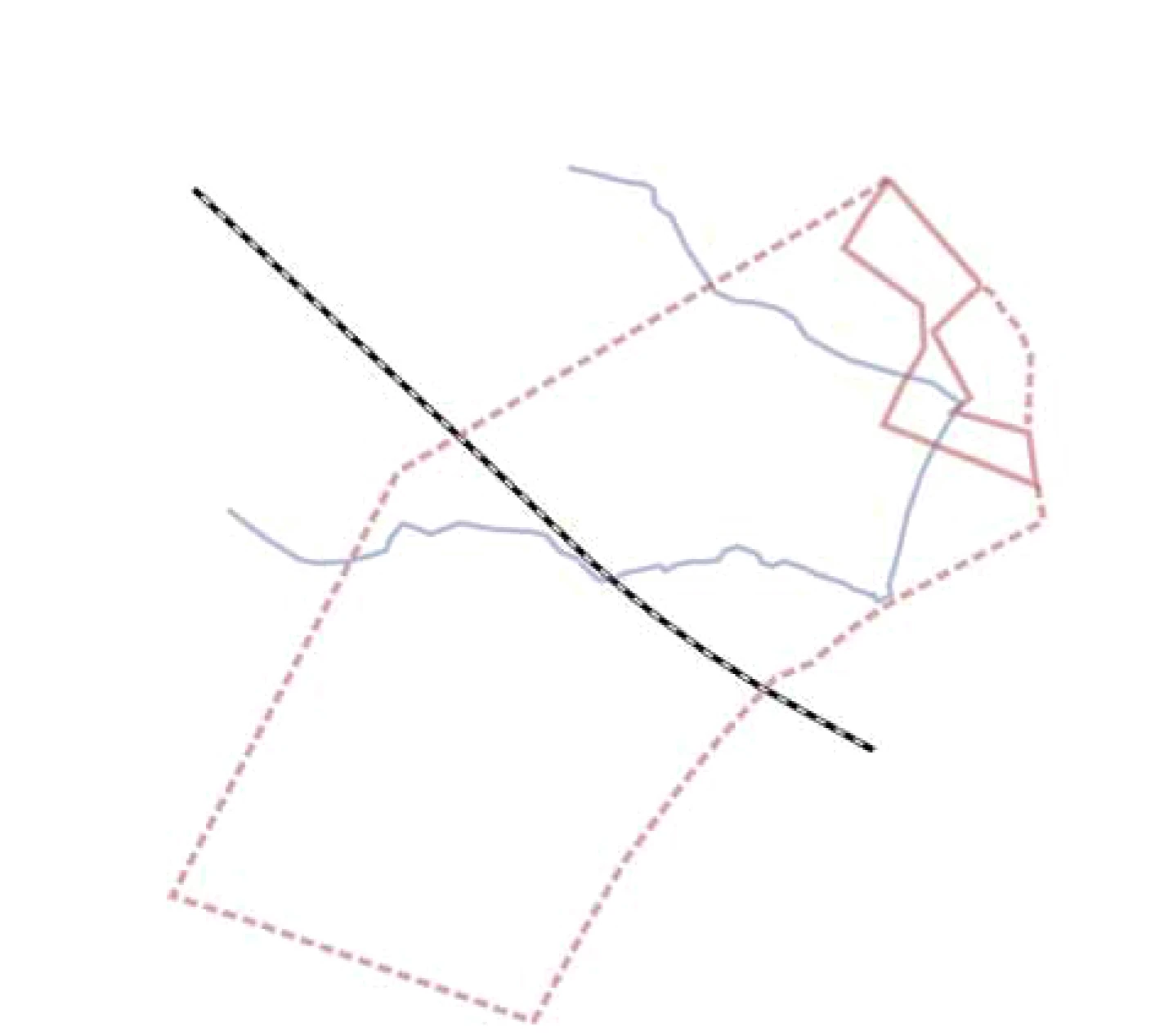
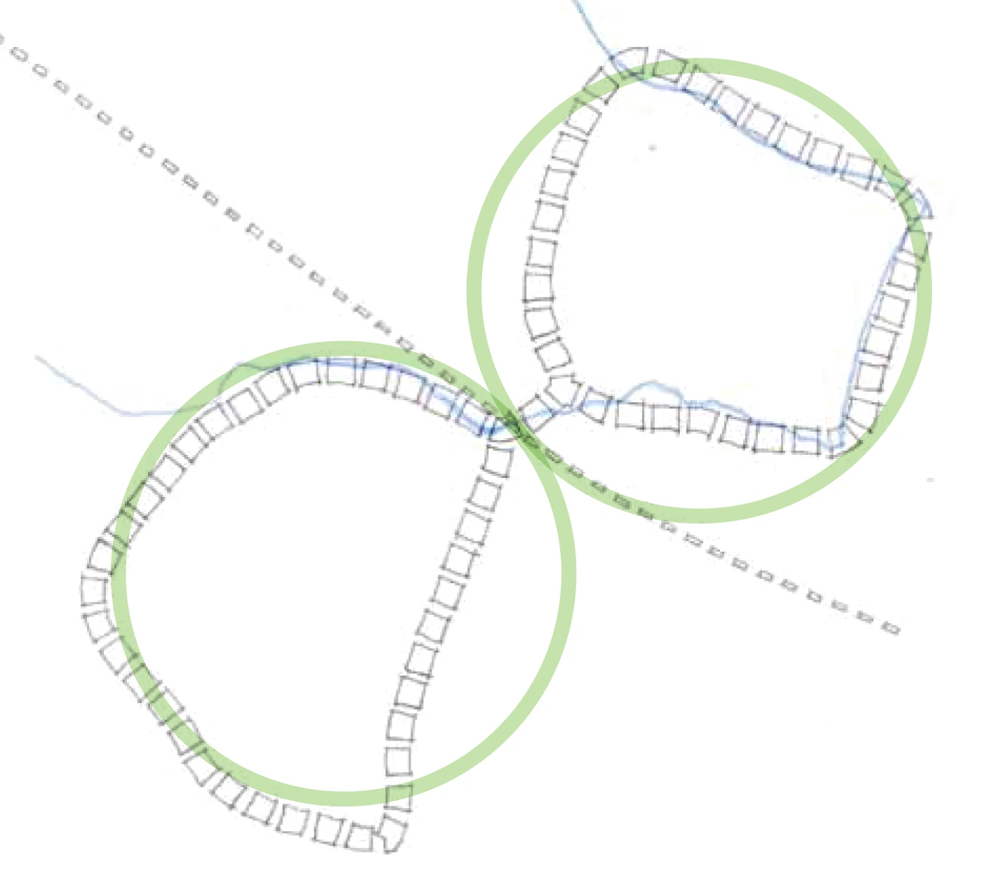
A place divided
The relationship between existing and proposed development highlights the need for connections across their boundaries.
Space to … live!
Shared landscape spaces provide the basis for integrating the new development with its surroundings.
A place united
A connected landscape links the existing and proposed communities through shared routes and public spaces.
Design development
Key plan
The exemplar area within the wider masterplan.
Exemplar site masterplan
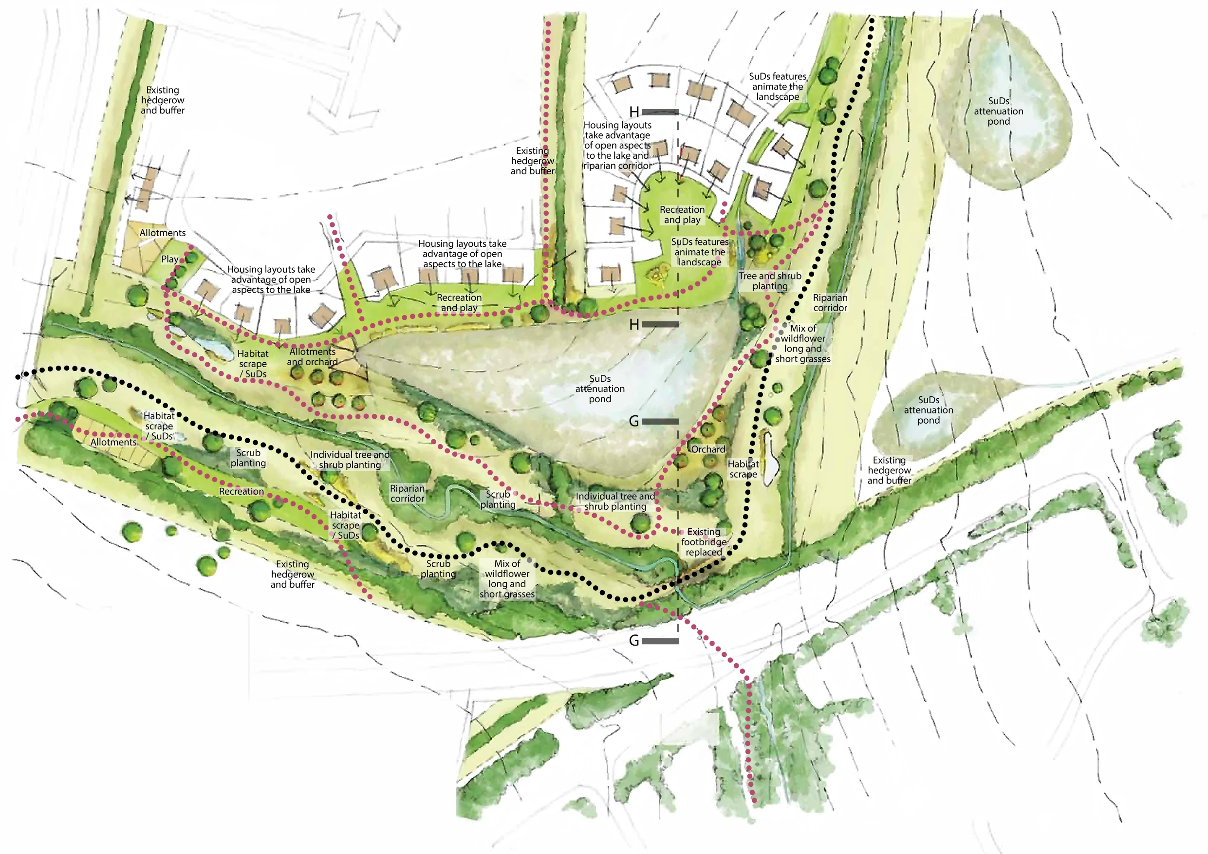
The retained riparian corridor and hedgerows form the ecological framework, with attenuation ponds and habitat scrapes integrated into adjoining open spaces. Allotments, orchards and recreation areas occupy the development edges, maintaining open views towards the water and landscape.
Community and pedestrian routes
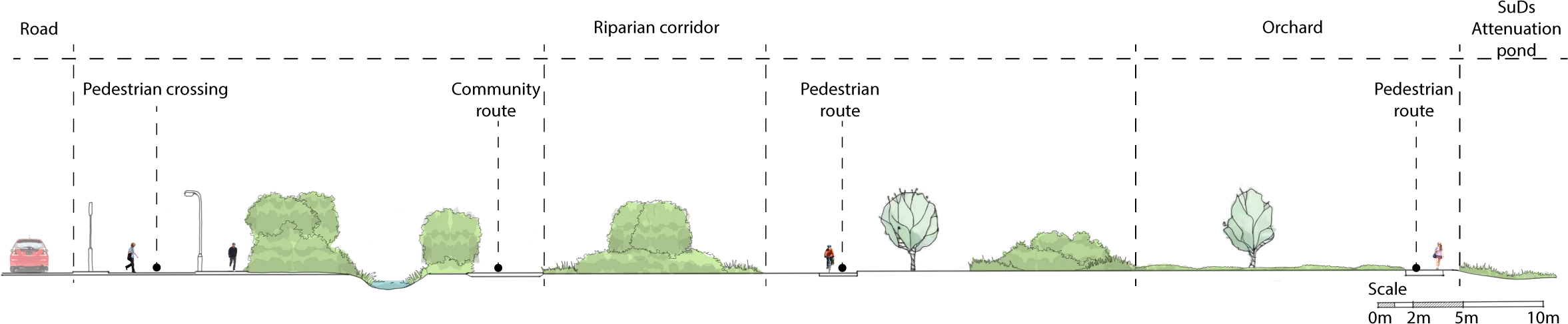
The community route connects development areas and shared amenities, while secondary footpaths provide access through the open spaces alongside the protected riparian corridor.
Section G–G
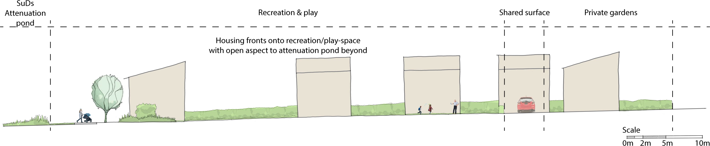
Section H–H
The residential frontage overlooks recreation and play space, with the attenuation pond beyond.











Design development
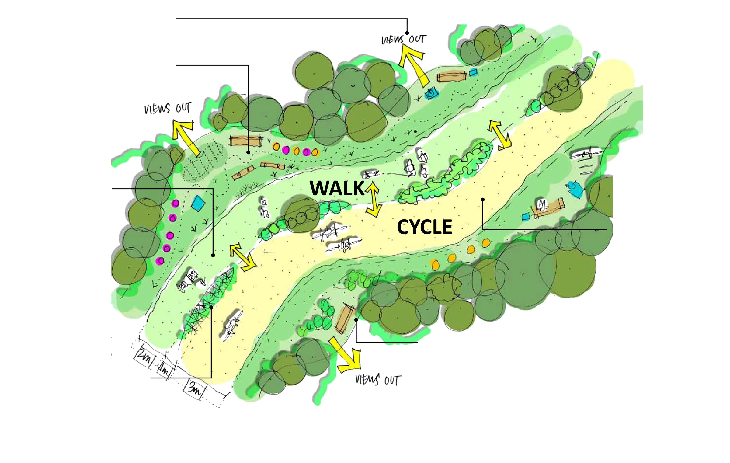
The green leisure loop for cyclists and pedestrians
A continuous route links recreation areas and open spaces, with dedicated paths for walking and cycling.
Walk
Cycle
Planting divider
A planted verge separates the footpath from the cycleway.
Breakout spaces and views out
Rest areas along the route provide places to pause, with views across the surrounding countryside.
Design development
Defining the edges
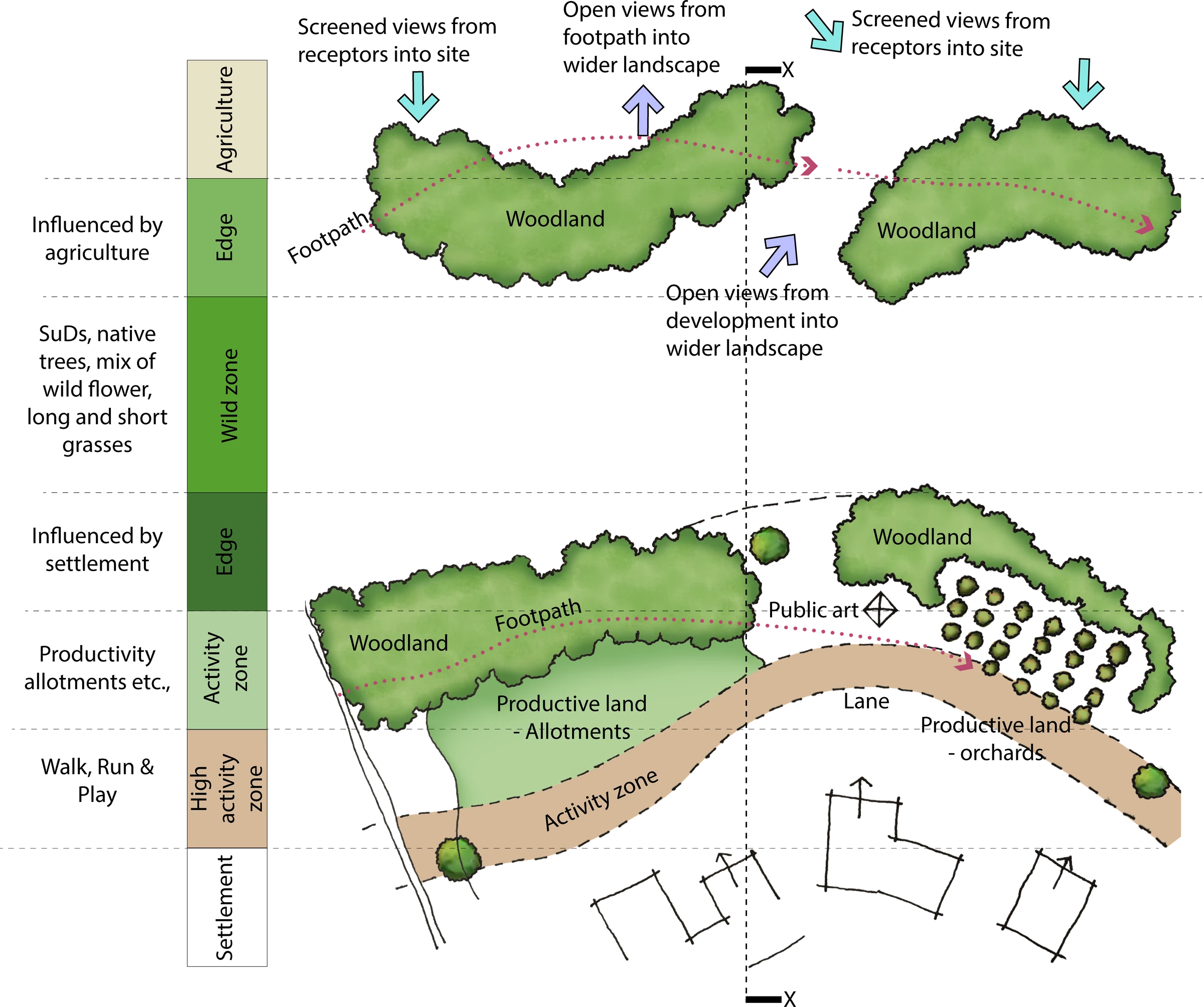
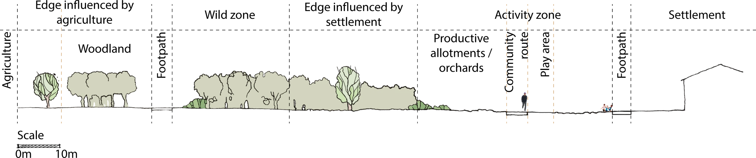
The boundary treatment creates a transition from residential development to agricultural land, combining active uses near the settlement with woodland and less intensively managed habitats beyond.
Section X–X
Allotments and orchards sit between recreation areas and woodland, balancing outward views with screening from the surrounding countryside.
Design development
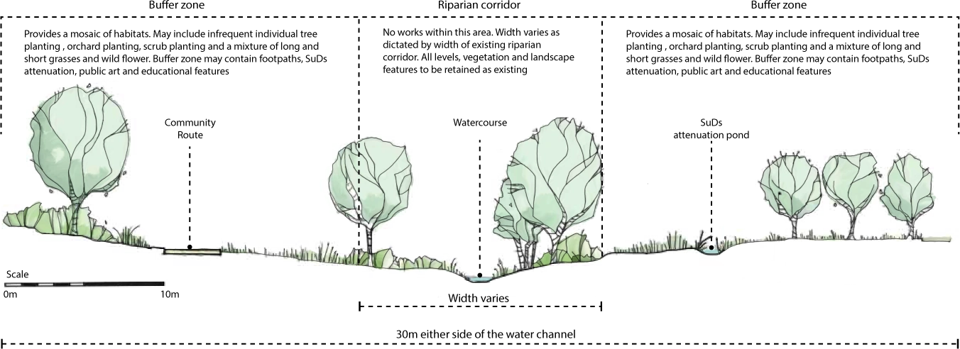
Typical section across water channel
The existing riparian corridor is retained without changes to its levels or vegetation. Adjacent buffers accommodate a mosaic of habitats, with footpaths and sustainable drainage features outside the protected corridor.
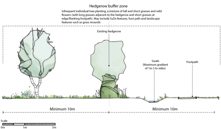
Typical section across hedgerow buffer zone
The existing hedgerow is retained within a planted buffer, protecting its habitat value and continuity through the development.